Your best days on the water
deserve better than a camera roll.
Add a photo, the way you already do. Riseform prefills the date, place and available conditions — tide, flow or sky, whatever water you fish. You stay in control, and your log ends up telling you what works for you.
Coming soon to iPhone and Android
- No account neededNo account
- Log usable with no signalOffline log
- Your spots stay privateSpots private
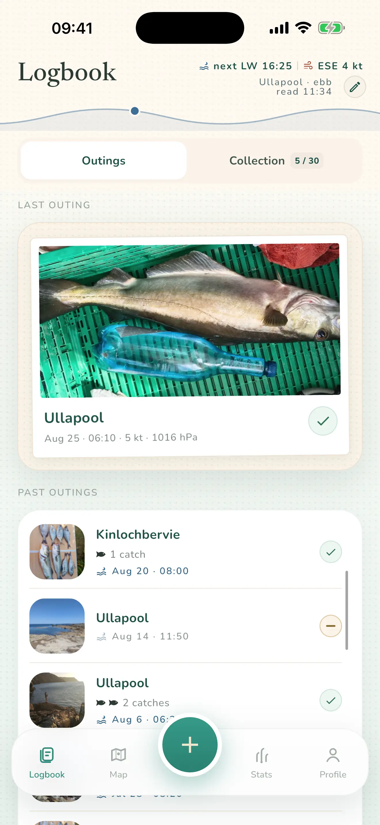
Works on tidal coasts, rivers, lakes and ponds — in France and elsewhere, where condition data are available.
You add a photo.
The app prefills the rest.
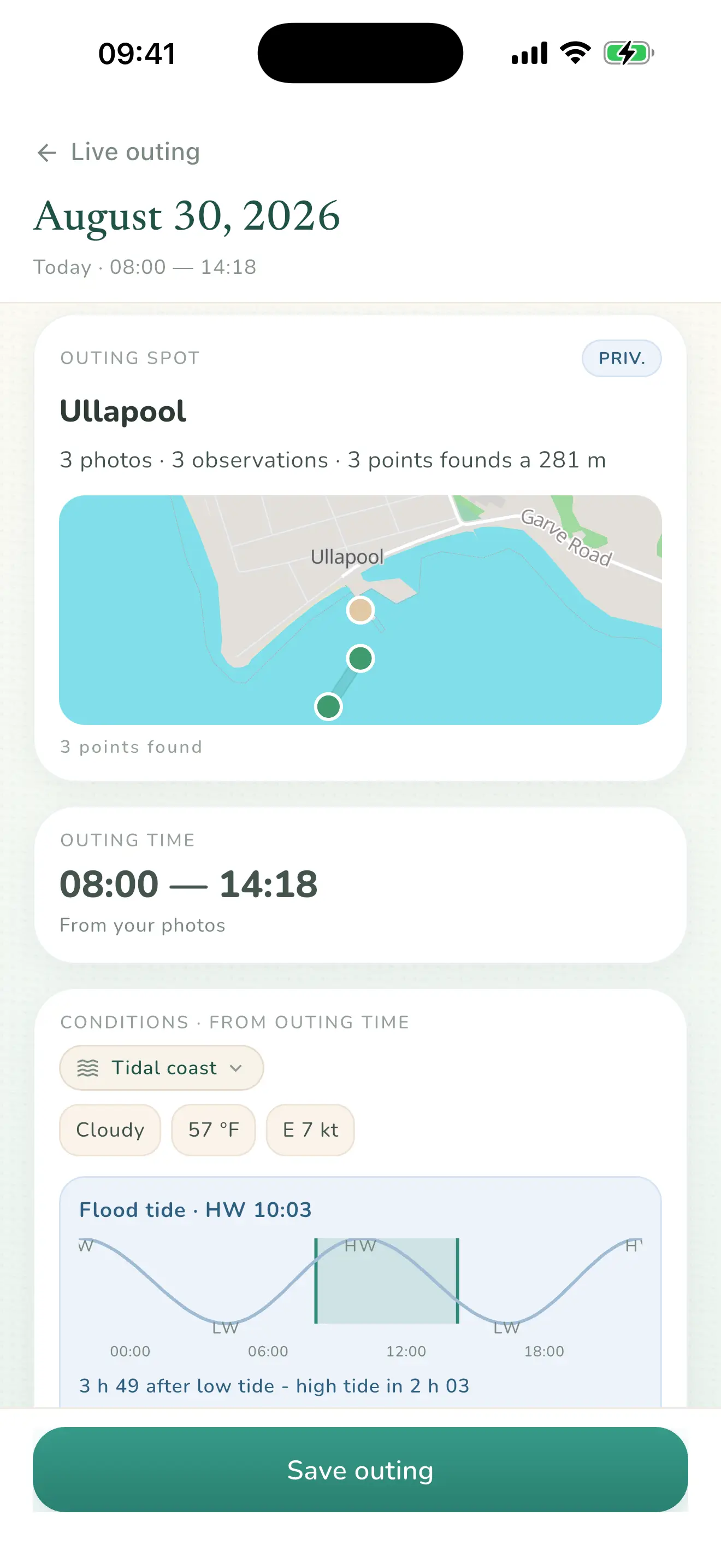
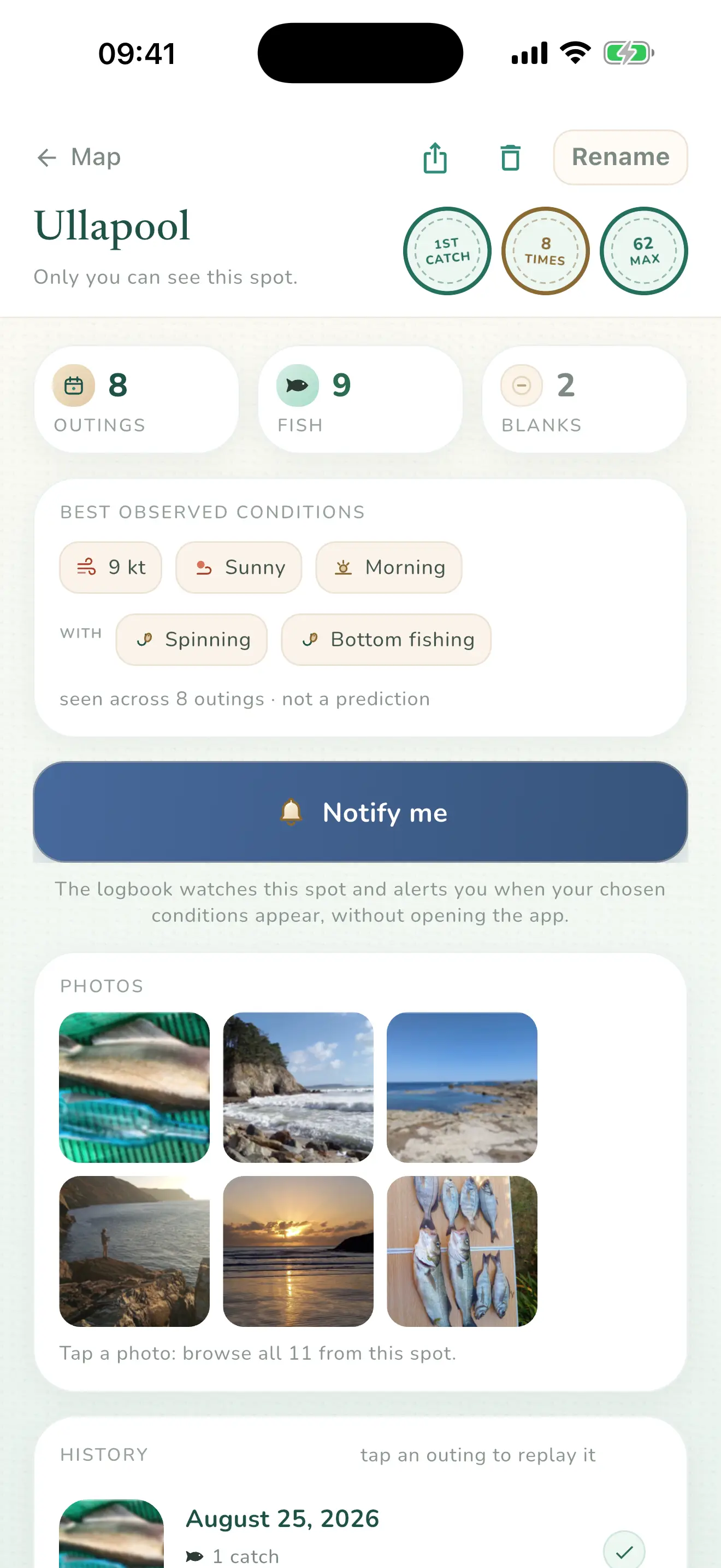
A photo can prefill the date, window, place and available conditions. You check and complete it, and trip after trip the spot remembers what worked.
Your log ends up knowing
what you only sense.
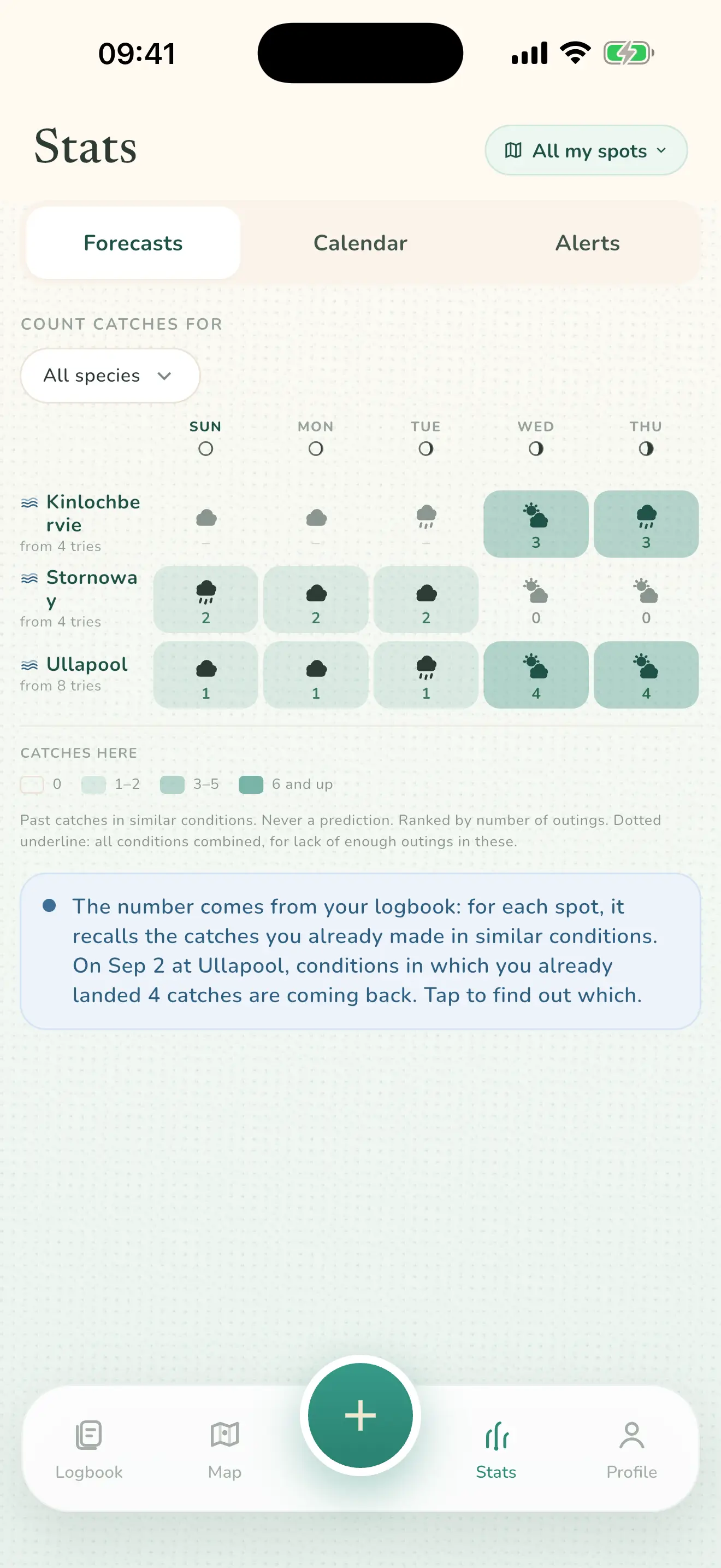
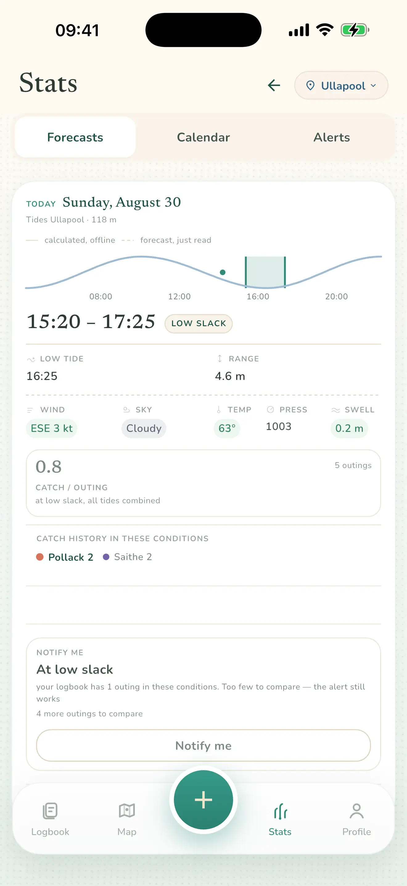
The Patterns screen — all your spots, five days.
- Computed on your trips, never on an average
- Carried across the next five days, spot by spot
- Species by species, season after season
The more comparable trips your log contains, the more context its patterns have. No score out of ten, no “spot of the day”, no catch prediction
What your logbook says about it is free. The almanac of the window — tide, coefficient, wind, sky — and alerts are free. Only creating trips beyond the logbook limit requires a purchase.
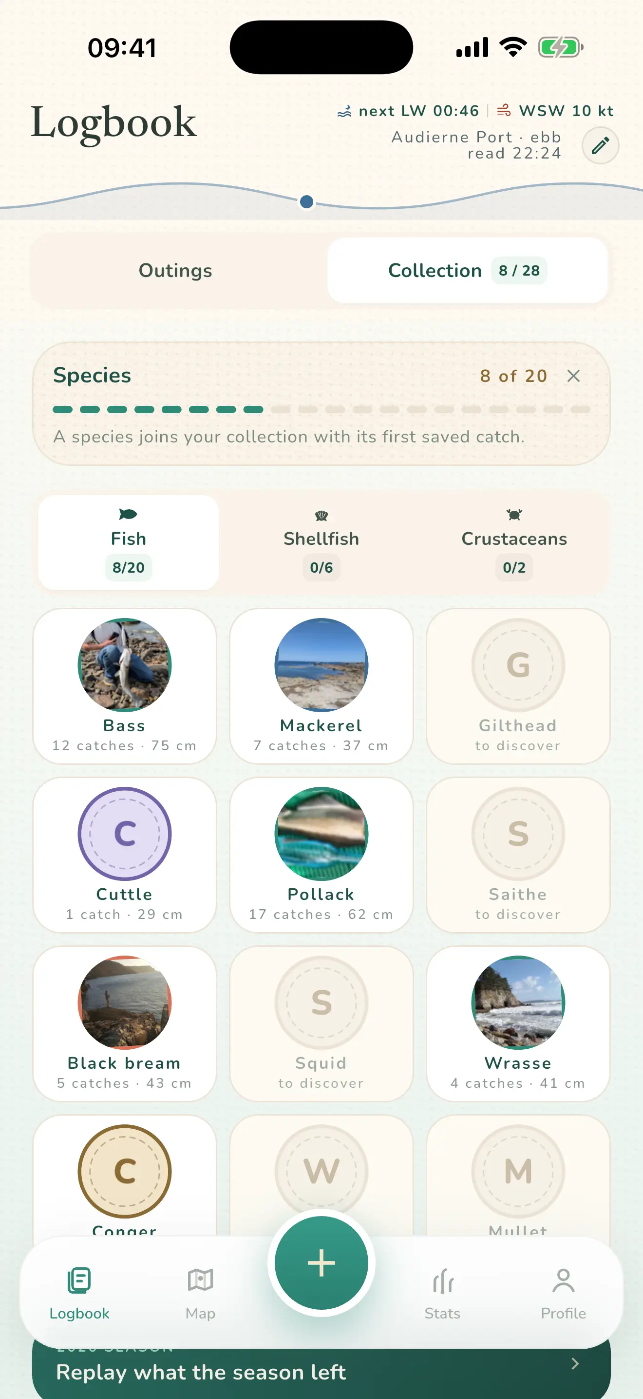
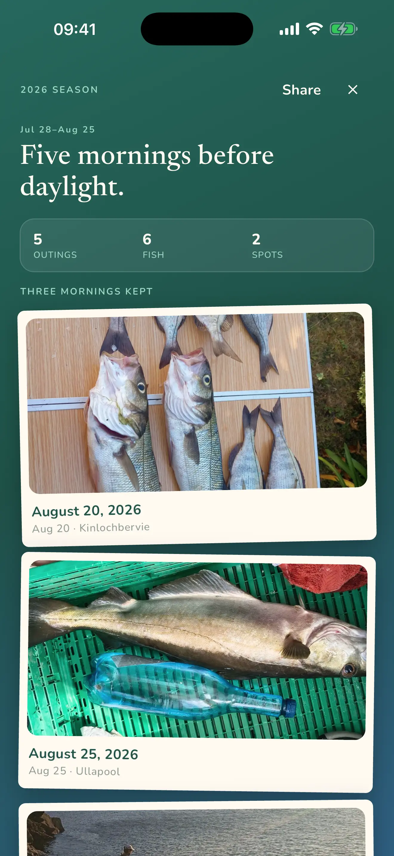
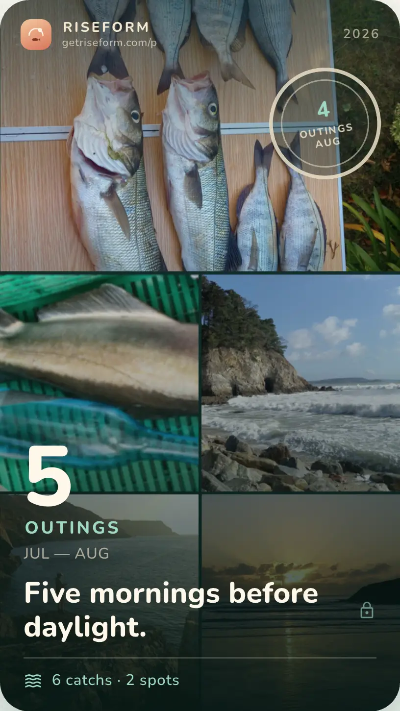
Your best catches,
your season remembered.
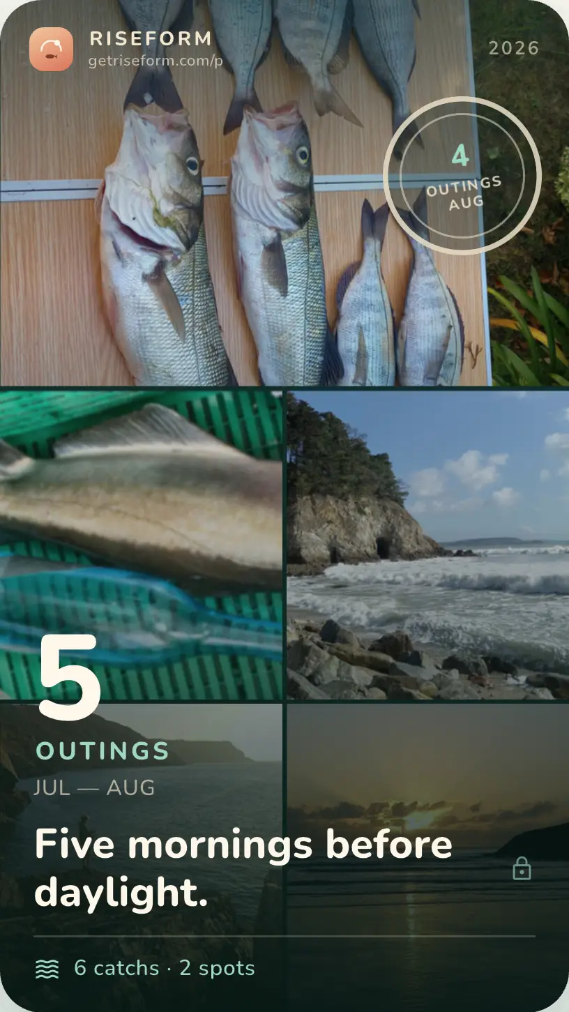
Riseform brings your best days back up and turns your year into a card you can keep to yourself — or send to the people who were there. Nothing is ever posted for you.
- Your spot names masked by default
- Twenty-eight species to reveal — twenty fish, six shellfish, two crustaceans
- Every square fills with your own photo, never an illustration
- Stamps earned on a real fact, never on a streak
Keep it, or send it. What leaves: your photos, figures, date and the town shown on the card. What stays out of the file: the exact spot name and its coordinates.
You get the gear ready.
The app watches the water.
You name the condition — low-water slack at your spot, a low-flow reading, an overcast dawn. Riseform schedules a reminder on your phone when it returns; weather-based conditions need a network refresh.
- You choose the condition — the app never decides on its own that a moment is worth waking you
- Up to two notifications per alert, per month
- Spring tides included, up to thirty days ahead
Three trips created. Then an unlimited logbook.
The logbook is free, alerts included. You can create three trips; photos taken before your first import can still be imported later without counting. After that, the monthly or annual subscription — or the lifetime Founder purchase — lets the logbook keep growing without limits. Prices will show in the store when the listings open.
Can other anglers see my spots?
No. There is no feed, community map or leaderboard. Your log and exact spot names stay on your phone. A shared card may name a town or area, never the exact spot name, and no coordinate is written into the image. Network services used for weather, flow, maps and place names are detailed in the privacy policy.
Do I need a signal at the water?
The log remains readable and editable without a signal. Tide, range and the sun’s course are computed locally where the place is covered. Wind, sky, swell, some river flow data and place search need a connection; the app says when data are unavailable.
Does the app tell me where to fish?
Never. It gives no score out of ten, no “spot of the day”, no prediction. It shows you what your own trips gave in comparable conditions — with the trip count and the blank days, so you can judge how solid the number is yourself.
Do I have to turn on location services?
No. Riseform does not track you and never uses location in the background. Permission may be requested only after an explicit action, for example when you ask to use your current position. You can refuse and continue with photo metadata or a point placed by hand.
How long does it take to record a trip?
You can start with a photo, then add species, length, lure or notes whenever you choose. The time therefore depends on the detail you want; Riseform prefills what it can without inventing what is missing.
Does it work on rivers, on lakes, or on the Mediterranean?
Yes. The screen adapts to the water and the data available. On rivers, Riseform first looks for a Hubeau gauge in France, then may use an Open-Meteo hydrological series. On the Mediterranean it emphasises sky, temperature and wind. On lakes, you can also record the water level yourself.
What happens if I change phone?
You take your log with you, and it costs nothing. From the Profile, a full backup — trips, catches and photos — goes wherever you choose: your drive, your computer, a stick. The new phone reads it back. Riseform has no server, so your backup never passes through us. The export, for its part, writes everything out as readable JSON: your data is yours, and nothing holds you here.
What about shore gathering at low tide?
The catalogue holds twenty-eight species, six of them shellfish and two crustaceans: a clam is recorded exactly like a bass, with its photo, its time and its tidal range. The calendar shows the month’s spring tides, and a spring-tide alert can be armed up to thirty days ahead — an almanac figure is exact three months out, where a forecast wind stops being one past thirty-six hours.
How do condition alerts work?
You arm them: pick a spot and a condition, and the app schedules the corresponding reminders. It never decides on its own that a moment deserves waking you, and the message stays factual. Each alert can produce up to two notifications per month. Alerts are free, like the whole logbook — trips, spots, collection, the window's almanac, backup, export and sharing. You can create three trips; photos taken before your first import can still be imported later without counting. Monthly Plus, Annual Plus or lifetime Founder then lifts the limit. Existing entries remain free to read and export.
Riseform is coming soon to iPhone and Android.
The logbook is free, alerts included, with no account or time limit. You can create three trips; photos taken before your first import can still be imported later without counting. Creating a fourth requires Monthly Plus, Annual Plus or lifetime Founder. Existing entries stay accessible. Store links will appear as soon as the listings are public.
- No account neededNo account
- Log usable with no signalOffline log
- Your spots stay privateSpots private